WHY CHOOSE US
Experts Trusted Us



Landscaping
Lorem ipsum dolor sit amet, consectetur adipiscing elit. Duis at est id leo

Pruning plants
Lorem ipsum dolor sit amet, consectetur adipiscing elit. Duis at est id leo

Lawn Maintenance
Lorem ipsum dolor sit amet, consectetur adipiscing elit. Duis at est id leo
ABOUT US
Nurture The environment
Lorem Ipsum is simply dummy text of free available market typesetting industry has been the industry's standard dummy

Lorem Ipsum is simply dummy text of free available market type setting industry
Ligula molestie
Dolor sit amet onsectetur adipisicing elit, sed do eiusmod tempor incididunt
Magna vivamus
Lorem ipsum dolor sit amet, consectetur adipisicing elit, sed do eiusmod
Efficitur velit
Lorem ipsum dolor sit amet, consectetur adipisicing elit, sed do eiusmod
WHAT WE DO
Services for You
Landscaping
Lorem ipsum dolor sit amet, consectetur adipiscing elit. Duis at est id le

Pruning plants
Lorem ipsum dolor sit amet, consectetur adipiscing elit. Duis at est id le

Lawn Maintenance
Lorem ipsum dolor sit amet, consectetur adipiscing elit. Duis at est id le
Lawn Maintenance
Lorem ipsum dolor sit amet, consectetur adipiscing elit. Duis at est id le

Features Product
OUR GARDEN STORE

Lorem ipsum dolor sit amet

Lorem ipsum dolor sit amet

Lorem ipsum dolor sit amet

Lorem ipsum dolor sit amet
MEET OUR OWNER
Jeff Weidner


Finished Work
Dummy text of free available
Finished Work
Dummy text of free available

Finished Work
Dummy text of free available

Finished Work
Dummy text of free available

Finished Work
Dummy text of free available

Finished Work
Dummy text of free available
CLIENT TESTIMONIALS
What our clients say

Jane Doe
Lorem Ipsum is simply dummy text of free available market typesetting industry has been the industry's standard dummy text ever. Lorem Ipsum is simply dummy text of free available

Jane Doe
Lorem Ipsum is simply dummy text of free available market typesetting industry has been the industry's standard dummy text ever. Lorem Ipsum is simply dummy text of free available

John Doe
Lorem Ipsum is simply dummy text of free available market typesetting industry has been the industry's standard dummy text ever. Lorem Ipsum is simply dummy text of free available
ATTENTION: Contractors, stakeholders, real estate investors
Construction Progress Monitoring Services in North Carolina
Document Every Milestone. Keep Every Stakeholder Informed.
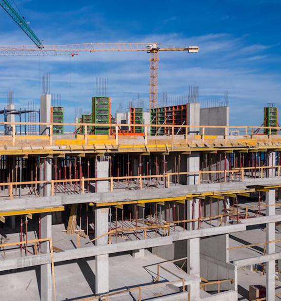
Successful construction projects depend on clear communication, accurate documentation, and timely decision making. Carolina Crop Spray and Aerial Solutions provides professional drone photography and video services that help contractors, developers, engineers, investors, and property owners monitor project progress from groundbreaking through completion.
Our scheduled aerial documentation captures every phase of construction, creating a comprehensive visual record that supports project management, improves communication, and provides valuable marketing content long after the project is complete.
Whether you're building a commercial development, industrial facility, residential community, or infrastructure project, our aerial imagery helps you track progress with confidence.
Why Invest in
Construction Progress Monitoring?
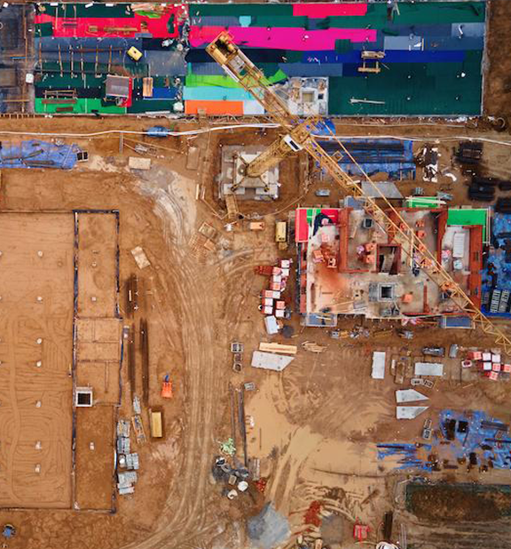
Construction projects involve dozens of stakeholders, changing site conditions, and critical deadlines. Ground-level photos often fail to capture the complete picture, making it difficult to communicate progress or identify developing issues.
Professional drone documentation provides a consistent aerial perspective throughout the life of the project, allowing everyone involved to see exactly how work is progressing.
Benefits of Commercial Drone Photography
Document every stage of construction from start to finish.
Improve communication with owners, investors, and project stakeholders.
Track progress against schedules and milestones.
Create visual records for project documentation.
Identify site changes before they become costly problems.
Reduce unnecessary site visits.
Produce professional marketing content while the project is underway.
Preserve a permanent record of the completed project.
Construction Projects We Photograph
Office Buildings
Industrial Facilities
Warehouses
Distribution Centers
Manufacturing Plants
Retail Centers
Shopping Centers
Medical Offices
Apartment Communities
Hotels
Mixed-Use Developments
Land Development Projects
Investment Properties
Commercial Construction Sites
Residential Homes
Who's This Perfect For
Our services are designed for organizations that need
reliable project documentation and clear visual communication.
Add Subtext text. Click "Edit Text" to update the font, size and more.
To change and reuse text themes, go to Site Styles.
general contractors
home owners
commercial developers
property owners
real estate agents
property managers
architects
engineering firms
investors
asset managers
financial managers
government agencies
real estate brokers
municipalities
planning boards
Whether you're listing a property for sale, attracting new tenants, documenting improvements, or presenting a project to investors, professional aerial imagery helps communicate value with clarity and impact.
Why Choose Carolina Crop Spray and Aerial Solutions?
Construction progress monitoring is more than taking aerial photographs. It is about providing accurate, consistent, and reliable documentation that supports better communication and better project management.
Carolina Crop Spray combines professional drone operations with careful planning to deliver repeatable imagery that allows meaningful comparisons throughout the life of your project. Every mission is conducted safely and in accordance with applicable FAA regulations, ensuring dependable results you can rely on.
Benefits of Professional Drone Photography
Capture unique perspectives unavailable from the ground
High resolution photography suitable for large prints and publications
Professional 4K video for websites and social media
Showcase large properties and landscapes
Document projects over time
Reduce costs compared to traditional aerial photography
Fast scheduling and efficient project completion
Commercial Real Estate Photography
and Videography Services
Every commercial property is different, which is why we tailor our aerial photography and video services to your marketing and documentation goals.
Property Marketing Photography
Capture professional aerial images that highlight your building, surrounding property, parking areas, access roads, and nearby amenities. Perfect for commercial listings, brochures, investor presentations, and company websites.
Cinematic Drone Video
Create engaging aerial video that showcases the property's scale, architecture, and location. Professional drone footage helps buyers, tenants, and investors gain a better understanding of the property before scheduling a visit.
Development & Construction Progress
Document every phase of construction with scheduled aerial photography and video. Create a visual timeline that keeps stakeholders informed and provides valuable records for project management and marketing.
Investment & Asset Documentation
Maintain an accurate visual record of commercial assets for inspections, insurance documentation, maintenance planning, financing, and investor reporting.
Site & Location Overviews
Demonstrate what makes your property unique by capturing nearby highways, transportation corridors, surrounding businesses, utilities, and local amenities. Aerial imagery provides valuable context that traditional photography cannot.
Marketing Content for Every Platform
Receive professionally edited images and video optimized for commercial real estate listings, MLS platforms, websites, social media, email campaigns, digital advertising, and printed marketing materials.
Our Process

Consultation
We discuss your project, reporting requirements, schedule, and desired deliverables to create a monitoring plan that supports your objectives.

Flight Planning
Each flight is planned with consistent flight paths, camera angles, and altitudes whenever practical. This allows meaningful comparisons throughout the project's lifecycle.

Scheduled Site Visits
We capture high resolution aerial photography and video according to your preferred schedule, ensuring consistent documentation from beginning to end.
Editing
Images and video are professionally processed for clarity, color accuracy, and presentation while preserving an authentic representation of the project.
Digital Delivery
Completed files are delivered electronically, making it easy to share updates with project teams, clients, investors, and stakeholders.
Ready to get started?
STILL NOT SURE?
Frequently Asked Questions
How often can construction progress be documented?
Projects can be photographed on a weekly, bi-weekly, monthly, or custom schedule based on your reporting needs.
Can you match the same camera angles for every visit?
Yes. We use consistent flight planning whenever practical to create comparable imagery throughout the project.
Do you provide both photos and video?
Yes. We offer high resolution photography, cinematic aerial video, or a combination of both depending on your requirements.
Can progress images be used for marketing?
Absolutely. Professionally edited aerial imagery is ideal for websites, social media, proposals, annual reports, and project portfolios.
What happens if the weather is poor?
Flights may be rescheduled to ensure safe operations and the highest quality results. We do not fly in rain or high winds.
Do you travel throughout North Carolina?
Yes. Carolina Crop Spray proudly provides construction progress monitoring services across North Carolina.
Related Services
FOLLOW THE LINKS BELOW TO RELATED SERVICES
need drone photos and videos
Keep Your Project Moving Forward
From the first shovel in the ground to the final ribbon cutting, professional construction progress monitoring provides the visual documentation your team needs to communicate clearly, document milestones, and showcase the success of your project.
Request a Free Quote Today
Partner with Carolina Crop Spray to create a complete visual record of your construction project with professional aerial photography and video services throughout North Carolina.
Add Subtext text. Click "Edit Text" to update the font, size and more.
To change and reuse text themes, go to Site Styles.
Call Carolina Crop Spray to discuss your project and schedule your flight.
(910) 400-8859

Carolina Crop Spray LLC
Copyright 2026 All rights reserved
6108 Tiffield Way Wake Forest, NC 27587
[email protected]
(910) 400-8859

