WHY CHOOSE US
Experts Trusted Us



Landscaping
Lorem ipsum dolor sit amet, consectetur adipiscing elit. Duis at est id leo

Pruning plants
Lorem ipsum dolor sit amet, consectetur adipiscing elit. Duis at est id leo
Lawn Maintenance
Lorem ipsum dolor sit amet, consectetur adipiscing elit. Duis at est id leo
ABOUT US
Nurture The environment
Lorem Ipsum is simply dummy text of free available market typesetting industry has been the industry's standard dummy

Lorem Ipsum is simply dummy text of free available market type setting industry
Ligula molestie
Dolor sit amet onsectetur adipisicing elit, sed do eiusmod tempor incididunt
Magna vivamus
Lorem ipsum dolor sit amet, consectetur adipisicing elit, sed do eiusmod
Efficitur velit
Lorem ipsum dolor sit amet, consectetur adipisicing elit, sed do eiusmod
WHAT WE DO
Services for You
Landscaping
Lorem ipsum dolor sit amet, consectetur adipiscing elit. Duis at est id le

Pruning plants
Lorem ipsum dolor sit amet, consectetur adipiscing elit. Duis at est id le

Lawn Maintenance
Lorem ipsum dolor sit amet, consectetur adipiscing elit. Duis at est id le
Lawn Maintenance
Lorem ipsum dolor sit amet, consectetur adipiscing elit. Duis at est id le

Features Product
OUR GARDEN STORE

Lorem ipsum dolor sit amet

Lorem ipsum dolor sit amet
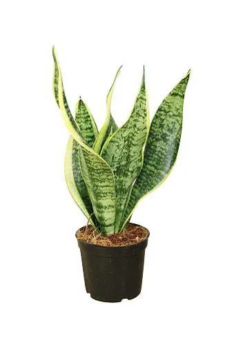
Lorem ipsum dolor sit amet
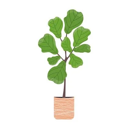
Lorem ipsum dolor sit amet
MEET OUR OWNER
Jeff Weidner


Finished Work
Dummy text of free available
Finished Work
Dummy text of free available

Finished Work
Dummy text of free available

Finished Work
Dummy text of free available

Finished Work
Dummy text of free available

Finished Work
Dummy text of free available
CLIENT TESTIMONIALS
What our clients say

Jane Doe
Lorem Ipsum is simply dummy text of free available market typesetting industry has been the industry's standard dummy text ever. Lorem Ipsum is simply dummy text of free available

Jane Doe
Lorem Ipsum is simply dummy text of free available market typesetting industry has been the industry's standard dummy text ever. Lorem Ipsum is simply dummy text of free available

John Doe
Lorem Ipsum is simply dummy text of free available market typesetting industry has been the industry's standard dummy text ever. Lorem Ipsum is simply dummy text of free available
ATTENTION: commercial real estate owners, brokers and agents
Orthomosaic Mapping Services in North Carolina
Turn Drone Imagery Into Accurate Maps That Support Better Decisions
Aerial photographs are beautiful. Orthomosaic maps are powerful business tools.
Carolina Crop Spray provides professional orthomosaic mapping services that transform hundreds of overlapping drone images into a single, high resolution, geographically accurate map of your property. Unlike a standard aerial photograph, an orthomosaic can be measured, analyzed, shared, and used for planning, documentation, and decision making.
Whether you're managing farmland, planning construction, documenting property conditions, or monitoring large sites, orthomosaic maps provide the accurate information needed to make confident decisions.
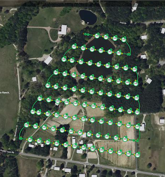
What Is an Orthomosaic Map?
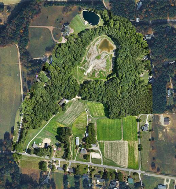
An orthomosaic is created by combining hundreds or even thousands of overlapping aerial photographs into one seamless image. Each photograph is corrected for camera angle, terrain, and distortion, producing an accurate map where distances, areas, and locations can be measured with confidence.
The result is a highly detailed aerial map that provides a complete view of your property while maintaining geographic accuracy.
Unlike ordinary drone photography or satellite images, orthomosaic maps are designed to support in real-time planning, analysis, documentation, and long-term record keeping.
Why Choose Orthomosaic Mapping?
Many projects require more than attractive aerial photographs. They require accurate information.
Orthomosaic maps allow property owners, contractors, engineers, and agricultural professionals to view an entire site at once while maintaining the accuracy needed for planning and decision making.
Benefits of Commercial Drone Photography
Create an accurate map of your entire property.
Measure distances, acreage, and surface areas.
Document property conditions before and after projects.
Monitor changes over time.
Improve communication with stakeholders.
Reduce unnecessary site visits.
Support planning, reporting, and project management.
Maintain permanent visual records.
What You'll Receive
Deliverables may include:
High resolution orthomosaic maps
Georeferenced aerial imagery
Large format digital maps
High resolution aerial photographs
Project documentation imagery
Before and after comparisons
Digital map files
Images suitable for reports and presentations
Who's This Perfect For
Farmers
Ranchers
commercial property owners
investors
real estate agents
property managers
agrotourism farms
restaurants
general contractors
asset managers
golf courses
engineering firms
architects
municipalities
planning boards
Our mapping services help organizations make better decisions by providing accurate aerial data.
Why Choose Carolina Crop Spray and Aerial Solutions?
Accurate mapping begins with careful planning.
Carolina Crop Spray combines professional drone operations with modern mapping technology to produce reliable orthomosaic maps that support informed decision making.
Every mission is planned to maximize image quality, accuracy, and consistency while operating safely and in accordance with applicable FAA regulations.
Whether you're managing crops, overseeing construction, documenting property conditions, or planning future development, our mapping services provide dependable aerial data you can trust.
Orthomosaic Mapping Applications
Every project has unique objectives. Carolina Crop Spray customizes each mapping mission to provide information that supports your business goals.
Agricultural Field Mapping
Create accurate aerial maps that provide a complete view of crop fields, drainage systems, irrigation infrastructure, field boundaries, and changing conditions throughout the growing season.
Construction Site Documentation
Monitor construction progress with repeatable maps that allow project teams to compare changes, communicate milestones, and maintain detailed project records.
Property Documentation
Produce accurate maps of commercial, industrial, residential, and agricultural properties that support maintenance planning, insurance documentation, and asset management.
Land Development Planning
Document existing site conditions before construction begins, providing developers, engineers, and stakeholders with a current visual record of the property.
Storm Damage Assessment
Capture accurate aerial maps following hurricanes, flooding, hail, or severe weather to document affected areas, support insurance claims, and assist with recovery planning.
Long-Term Monitoring
Schedule repeat mapping flights throughout the year to monitor construction, agricultural production, environmental changes, restoration projects, or property improvements.
Our Process

Consultation
We discuss your project, objectives, preferred angles, and final deliverables.

Flight Planning
Each mission is planned around weather, lighting, FAA requirements, safety, and property conditions.

Image Capture
Our drone captures high quality photographs and cinematic video from multiple perspectives to ensure complete coverage.
Editing
Images and video are professionally processed to deliver polished, high quality results while maintaining a natural appearance.
Delivery
Final files are delivered digitally in formats suitable for print, websites, presentations, or social media. jpg, png, mp4
Ready to get started?
STILL NOT SURE?
Frequently Asked Questions
How is an orthomosaic different from a regular aerial photograph or satellite images?
An orthomosaic is corrected for distortion and assembled from hundreds of overlapping images, producing a geographically accurate map that can be measured and analyzed. We can provide them in near real time and have your images back in 24 to 48 hours.
Can an orthomosaic be used to measure acreage?
Yes. Orthomosaic maps can be used to calculate acreage, distances, and surface areas with a high degree of accuracy when produced with appropriate workflows.
How large of an area can be mapped?
Projects range from small commercial properties to hundreds of acres of farmland or construction sites.
How long does processing take?
Processing time depends on project size and image volume, but most projects are delivered within several business days. Most projects are completed in 48 hours.
What happens if the weather is poor?
Flights may be rescheduled to ensure safe operations and the highest quality results. We do not fly in rain or high winds.
Do you travel throughout North Carolina?
Yes. Carolina Crop Spray and Aerial Solutions proudly provides commercial drone photography services across North Carolina.
Related Services
FOLLOW THE LINKS BELOW TO RELATED SERVICES
need drone photos and videos
Make Better Decisions
with Better Maps
An orthomosaic map provides more than a bird's-eye view. It delivers accurate information that supports planning, communication, documentation, and informed decision making.
Whether you're managing farmland, overseeing construction, developing property, or documenting important assets, Carolina Crop Spray and Aerial Solutions provides professional orthomosaic mapping services designed to help you work smarter in near real time.
Request Your Free Quote Today
Partner with Carolina Crop Spray and Aerial Solutions to transform aerial imagery into accurate maps that provide lasting value for your business.
Add Subtext text. Click "Edit Text" to update the font, size and more.
To change and reuse text themes, go to Site Styles.
Call Carolina Crop Spray to discuss your project and schedule your flight.
(910) 400-8859

Carolina Crop Spray LLC
Copyright 2026 All rights reserved
6108 Tiffield Way Wake Forest, NC 27587
[email protected]
(910) 400-8859

